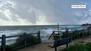
The Pacific Ocean is still officially in a La Niña phase, but signs suggest this pattern is losing strength. Climate experts now say the current La Niña may fade within weeks — and an El Niño could follow sooner than many expected.
La Niña Is Weak and Near Its Peak
On Thursday, the National Oceanic and Atmospheric Administration (NOAA) confirmed that La Niña conditions remain in place. Cooler-than-normal ocean temperatures are still present along the equatorial Pacific.
However, scientists believe the system is barely holding together.
“We are at or very near the peak of this weak La Niña,” said Nat Johnson, a meteorologist with NOAA. “We expect ocean temperatures to rise and shift toward neutral conditions within the next couple of months.”
NOAA’s key measurement, the Niño-3.4 index, recently came in at minus 0.5 degrees Celsius — the minimum threshold used to define a La Niña. Any warming beyond that would officially end the phase.
Neutral Phase Likely by February
Forecasts suggest La Niña will fade by February, transitioning the Pacific into what’s known as an ENSO-neutral phase. During this time, neither La Niña nor El Niño dominates.
But researchers believe that neutral period may be short-lived.
Could El Niño Return as Early as Summer?
Growing evidence shows the Pacific could flip back to El Niño by summer 2026. The reason lies deep in the western Pacific Ocean.
Warm Water Is Building in the West

During La Niña, strong trade winds push warm surface water westward, where it piles up near Asia — much like water sloshing to one side of a bathtub.
That’s exactly what has happened over the past several months.
While the eastern Pacific remains cooler, ocean waters in the western Pacific are among the warmest seen since records began in 1950. This massive heat buildup acts as stored energy that could fuel a future El Niño.
Winds Hold the Key
Short bursts of wind from the west, called westerly wind bursts, can push that warm water back toward the Americas. If strong enough, they can rapidly warm the entire Pacific basin — triggering El Niño conditions.
However, having warm water alone doesn’t guarantee El Niño will form.
Why Forecasting El Niño Is Tricky
Experts caution that many variables are still in play.
Johnson pointed to 2014 as a warning example. Back then, the Pacific looked very similar to today, with warm water building in the west and early wind activity suggesting a powerful El Niño.
“Then the winds refused to cooperate,” Johnson explained. “Easterly winds returned and shut the process down, delaying El Niño by an entire year.”
What Scientists Are Watching Next
The coming months will be critical.
If strong westerly winds develop and persist, the stored ocean heat could spread eastward quickly. That would increase the chances of a full El Niño forming by summer.
If not, the Pacific may stay neutral longer, reducing the risk of extreme global weather.
What This Means for California and the World
A fast return to El Niño would raise the odds of hotter-than-average global temperatures later in 2026.
For California, El Niño often brings wetter conditions, but recent years have shown that outcomes can vary widely. Some El Niño years produce major storms, while others fall short of expectations.
“We should keep a close eye on the surface winds in the tropical Pacific,” Johnson said. “If we see strong wind bursts, we’ll watch how the atmosphere responds.”
Conclusion
La Niña’s grip on the Pacific is weakening, and a shift toward neutral conditions is expected early next year. With unusually warm water building in the western Pacific, the possibility of El Niño returning by summer is real — but far from guaranteed. The next few months of wind patterns will determine whether the Pacific flips quickly or stays in limbo.