A long stretch of stormy weather is heading toward the Pacific Northwest, and forecasts show several cities could see up to 10 straight days of rain. Heavy downpours, river flooding, and mountain snow are expected as multiple atmospheric rivers hit Washington and Oregon next week.
Major Storms Lined Up for the Northwest
According to meteorologists, a series of strong atmospheric rivers will funnel huge amounts of Pacific moisture into the region.
Kayla Mazurkiewicz from the National Weather Service in Seattle said confidence is growing that western Washington could face widespread and possibly major river flooding during the first half of next week.
Why California Stays Dry
While the Pacific Northwest braces for storms, California will stay mostly dry due to a strong high-pressure system blocking storms from moving south. However, high clouds will still create beautiful sunrises and sunsets from San Francisco to Sacramento.
What Is Causing the Heavy Rain?
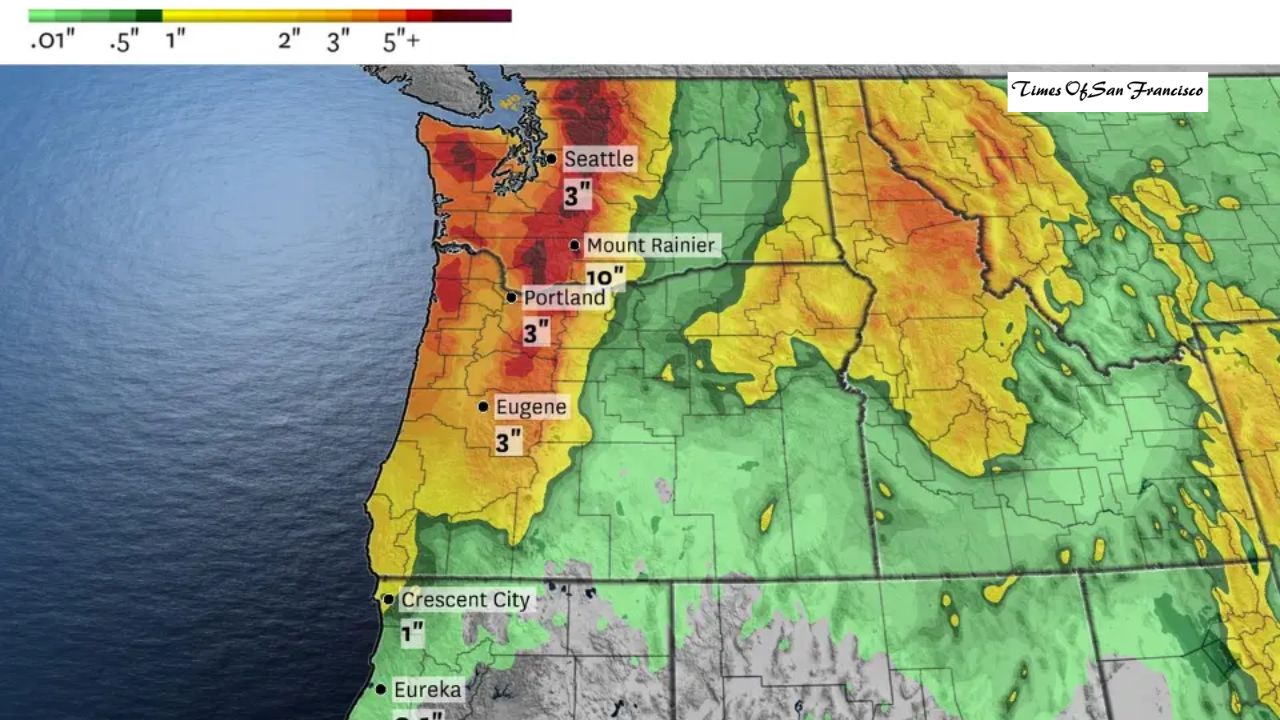
A long river of water vapor stretching across the Pacific Ocean will hit Washington and Oregon like a “fire hose.” Weather experts say three atmospheric river events will arrive over the next seven days.
- First storm: 2 to 4 inches of rain in the Cascades
- Weekend storm: A weaker system
- Monday–Wednesday storm: A major event with 5 to 10 inches of mountain rain
The National Water Center warns the heaviest rainfall — up to 4 inches per day — could fall between Monday and Wednesday.
Seattle Forecast: Rain for 10 Days Straight
Seattle, known for its rainy weather, is expected to see rain every day for the next 10 days. Total rainfall could reach 4 inches or more. Nearby cities like Everett and Tacoma may also see 10 straight days of rain.
20 Inches of Rain in the Mountains
By Friday, over 20 inches of precipitation could fall in the highest parts of Washington and Oregon. Most of this will be rain, raising flood concerns for the region.
Rivers expected to reach flood stage include:
- Cowlitz River
- Snoqualmie River
- Snohomish River
- Skykomish River
- Skagit River
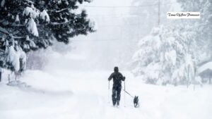
Heavy Snow on Tall Peaks
Mount Rainier and Mount Baker may receive more than 10 feet of snow at their summits since temperatures will stay below freezing at high altitudes.
Wind and Weather Impacts
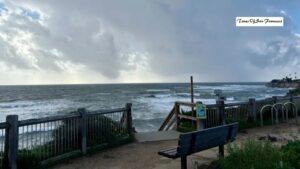
Windy conditions are expected, but none of the storms are forecast to produce damaging winds. Northern California’s Del Norte and Humboldt counties may get some light showers, but rainfall totals will be minimal.
Elsewhere in Northern California, temperatures will rise, reaching 10 degrees above normal in some areas.
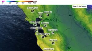
Thursday Weather Breakdown
San Francisco
- Morning lows in the low 40s — potentially the coldest in over 1,000 days
- Afternoon highs in the upper 50s to low 60s
- Light northeast winds up to 15 mph
North Bay
- Cold morning in the 30s
- Afternoon highs in the 50s–60s
- Patchy fog may return near Delta cities
East Bay
- Coldest morning of the season: mid-30s to low 40s
- Highs in the upper 50s to low 60s
- Chilly night ahead with lows in the upper 30s to mid-40s
Pacific Coast & Peninsula
- Morning temperatures in the mid-30s to low 40s
- Afternoon highs near the upper 50s
- Perfect conditions for a colorful sunset
South Bay & Santa Cruz
- Morning lows in the upper 30s to around 40 degrees
- Highs in the upper 50s to low 60s
- Calm winds and mild overnight conditions
Conclusion
The Pacific Northwest is preparing for a long week of storms, heavy rainfall, and the possibility of significant flooding as multiple atmospheric rivers move through the region. While Washington and Oregon brace for severe wet weather, California will stay mostly dry with colder mornings and mild afternoons. Residents in flood-prone areas should stay alert and follow updates from local authorities.