Christmas week is one of the busiest travel periods for Lake Tahoe, especially for skiing and snowboarding. But this year, many visitors are asking the same question: will there be enough snow to ski by Christmas? After one of the weakest season starts in nearly 50 years, the answer is not a simple yes or no.
Tahoe’s Snow Situation Right Now
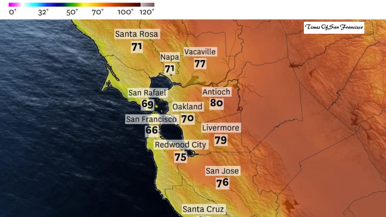
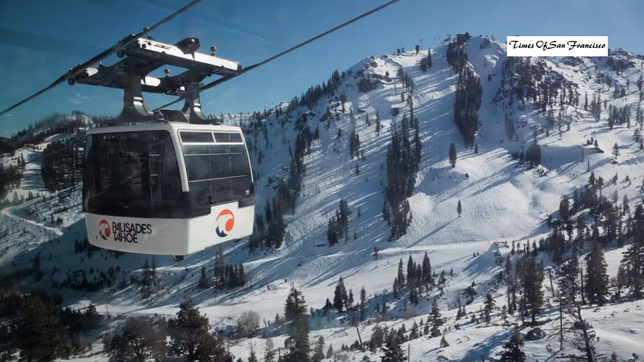
At the moment, natural snowfall in Tahoe has been very limited. Palisades Tahoe, California’s largest ski resort, is mostly closed, with only one small run open using artificial snow. While storm activity is increasing, warm temperatures are preventing snow from reaching ski resort levels.

In short, storms are coming—but most are bringing rain instead of snow.
Midweek Storm: Mostly Rain, Not Snow
What to Expect Late Tuesday Into Wednesday
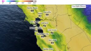
The first storm system is expected to arrive late Tuesday night and continue into early Wednesday. This system is relatively weak and carries warm air. When steady precipitation begins, temperatures near Lake Tahoe will be close to 40°F.
Snow levels are expected to stay near or above 9,000 feet. This means only the highest mountain peaks could see a small amount of snow. Ski resorts, which sit at lower elevations, will mostly receive rain.
Strong winds will also impact the region, with gusts over 100 mph along Sierra ridgelines and 30 to 50 mph at lower elevations.
Friday to Saturday Storm: Wetter, But Still Too Warm
More Moisture, Same Temperature Problem
A second storm is forecast to arrive Friday afternoon and last into Saturday. This system will bring more rain, but temperatures will remain too warm for widespread snowfall.
Snow levels are expected to stay above 8,000 feet through Saturday morning, keeping most ski resorts on the rain side once again. Any snow that does fall will be limited to the highest elevations.
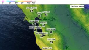
With temperatures remaining in the 30s and 40s, resorts will also struggle to make artificial snow between storms.
A Colder Shift After the Weekend
Sunday Night Into Monday Brings Some Hope
The weather pattern stays active heading into Christmas week, with new storms arriving every one to two days. A system expected late Sunday into Monday looks slightly colder, with snow levels potentially dropping to around 7,000 feet.
However, most of the moisture from this storm currently appears to be tracking north of Tahoe. If the storm shifts south, snowfall chances could improve, but for now, totals remain uncertain.
The Best Chance for Snow: After Christmas
Late-Week Storms Look More Promising
Looking further ahead, forecast confidence decreases, but the potential for snow improves. A storm expected around Tuesday night into Wednesday next week could bring the coldest air of the season so far.
Snow levels may drop to around 6,000 feet, which would allow many Tahoe ski resorts to finally see meaningful snowfall. If this system develops as expected, resorts could receive 6 to 12 inches of snow from higher elevations down toward base areas.
Another storm may follow around December 26 or 27. While details are still unclear, overall trends suggest colder systems becoming more likely as the holiday week continues.
Conclusion
Snow is on the way to the Sierra Nevada, but it is arriving slowly and with warmer temperatures than skiers would hope for. For those planning Christmas week ski trips, early conditions may remain limited, with rain dominating at resort levels.
The better window for skiing appears to be after Christmas, when colder storms have a stronger chance of turning rain into snow across Lake Tahoe. Visitors should monitor forecasts closely and prepare for changing conditions as the holiday season unfolds.