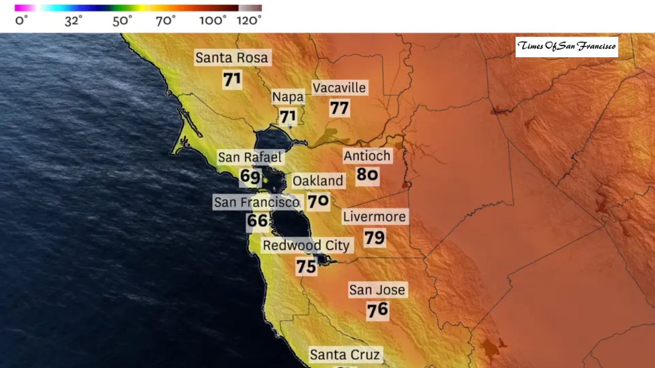
The Bay Area has been stuck in a cool, dry and cloudy weather pattern for weeks. The region has now gone 20 straight days without rain, and the effects are becoming noticeable. Dirt trails in the East Bay are drying out like summer, and some residents have even turned on sprinklers to water their plants.
Weather apps are now showing rain icons for next week — but how accurate are these early forecasts?
Will It Really Rain Next Week?

Based on current weather patterns, the answer is: Most likely, yes.
The main reason is that the strong high-pressure system — often referred to as the “ridiculously resilient ridge” — is finally weakening. This ridge has been blocking storms from reaching California, but it is expected to break down this weekend.
Storm Door Will Open
As the high pressure weakens, the jet stream will shift into a more direct west-to-east pattern, known as a zonal flow. This setup usually helps storms travel straight from the Pacific into California.
However, these early storms may be weak and fast-moving. They could bring only 0.25 to 0.5 inches of rain and won’t be strong enough to deliver large amounts of snow to the Sierra Nevada.
Why Weather Apps May Be Misleading
Many apps show rain starting Monday, but that is probably too optimistic. The first weather system is expected to be weak and may only bring a few light showers to the North Bay late in the day. Monday should not be considered a true rain day.
Better Chance of Rain on Tuesday
Models show stronger confidence for Tuesday. The jet stream will dip farther south, bringing in a system with more Pacific moisture — possibly a weak atmospheric river.
Still, Tuesday’s rainfall will likely be brief and light, lasting only a few hours. Some areas, especially the South Bay, might not see rain at all.
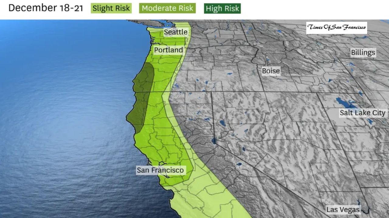
Next Weekend Could Bring the Strongest Storm
Weather apps show rain through next Friday, but predictions beyond 5–6 days are not reliable for exact rainfall amounts.
Overall, next Friday could offer the best chance for a more significant storm. Forecast models show:
- A stronger low-pressure system near the Pacific Northwest
- A colder, more powerful front moving over the Bay Area
- The possibility of tapping into subtropical moisture
This setup could create a moderately strong atmospheric river — but there is still uncertainty. The storm could weaken, shift north, or fail to produce much rain.
What to Expect After Next Week
After next Friday, storm chances will likely drop again as December continues. That means next week — especially the end of the week — is the Bay Area’s best opportunity to end the long dry spell.
Conclusion
The Bay Area’s dry pattern is finally showing signs of change. While weather apps are predicting rain, early forecasts should be taken cautiously, especially for Monday. Light showers are possible early next week, but the most promising chance for meaningful rain appears to be late next week. If the storm strengthens, it could break the region’s nearly three-week dry streak — but uncertainty remains. Stay tuned as weather models adjust in the coming days.