The Bay Area is off to one of its coldest Decembers in years. With thick fog covering many cities, temperatures have dropped more than usual, making this month feel colder than expected.
Coldest Start to December in Years
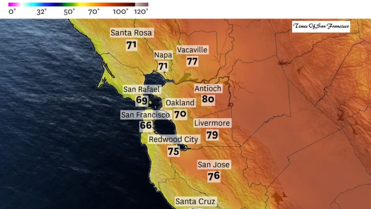
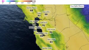
San Francisco is about 4 degrees colder than normal based on daily high temperatures, making this the coldest start to December since 2013. Other areas, especially the Central Valley, North Bay, and East Bay, are even colder — in some places, it’s the coldest December in nearly 50 years.

San Jose has been slightly warmer because of more sunshine. For the first nine days of December, temperatures there were only 1 degree below normal.
What’s Causing the Big Drop in Temperature?
The main reason is a thick layer of tule fog. This fog formed before Thanksgiving and has stayed in place for weeks, spreading from the Central Valley toward the Bay Area.
Tule fog forms on land, not from the ocean like San Francisco’s summer fog. It builds up in winter when nights are cold, clear, and still — especially after rain like California had recently.
Why the Fog Makes It So Cold
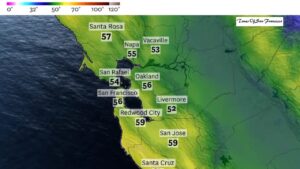
The fog blocks sunlight for days or even weeks, keeping temperatures low. Sacramento has been especially cold — between Nov. 16 and Dec. 9, only one day had a warmer-than-normal high temperature. Every other day was colder.
How Long Will This Cold Weather Last?
The cold spell doesn’t appear to be ending soon. There are no upcoming storms strong enough to clear the fog. Some areas in the North Bay, East Bay, and San Francisco may warm slightly by the weekend with a little afternoon sun, but the Central Valley — including Sacramento and Fresno — will likely stay cloudy and cold at least through mid-December.
Predicting whether the fog will last until the end of the month is still difficult.
A Temperature Inversion Is Making Things Even Stranger
This weather pattern is called a temperature inversion. Cold air stays trapped near the ground while warmer air sits above it. Because the winter sun is weak and low in the sky, it cannot burn the fog away. Without strong winds, the fog remains locked in place.
Interestingly, this has made places like Lake Tahoe warmer than Sacramento. Tahoe has been reaching the 60s and may even break December temperature records.
Some Areas Are Much Warmer
Coastal areas that escaped the fog have enjoyed sunny, pleasant afternoons:
- Big Sur is averaging 65°F.
- Santa Cruz and Monterey are also warmer than usual.
- Half Moon Bay has been reaching the 60s — warmer than any other Bay Area city this month.
- Los Angeles is in the low 80s, about 15 degrees above normal.
This Foggy Stretch Is One of the Longest in Years
This long-lasting tule fog is one of the thickest and most persistent since January 2011. That winter was even colder and came close to freezing temperatures on many nights. December 2021 also had a similar stretch of tule fog after a rainy fall.
Conclusion
The Bay Area’s cold start to December is mainly due to stubborn tule fog that has lowered temperatures across Northern California. With no strong weather system on the way to clear it out, this chilly pattern may continue into mid-December — and possibly longer. Until the fog lifts, expect cold mornings, cool afternoons, and limited sunshine in much of the region.